Destination File wizard page specifies resulting raster imagery format and location on a disk:
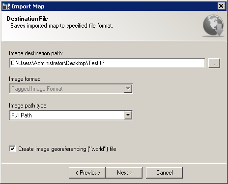
Import Map wizard Destination File page
This wizard page provides following options:
It also provides following navigation buttons:
Initially, destination image name is set to random string, while destination imagery path is set to temporary Windows folder: You can change it by clicking on  button next to the destination file name - the Select location to export Raster image file opens:
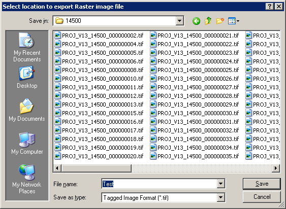
Raster imagery Save File dialog
Besides selecting target folder and file name, you also need to define output raster format. Default file format is TIFF (Tagged Image File Format), also enabling creating image georeferencing ("World") file accompanying output raster file - if this option is checked in wizard. Please note that not all formats provide creating image georeferencing file.
|
Please note that if you specified mosaicking image tiles, each image tile results in separate raster file. Thus each file on disk will have numerical suffix after specified file name. |
Following output image file formats are supported by TopoPlanner:
Extension |
World File |
Format Description |
TIF |
TFW |
Tagged Image File Format |
BMP |
BPW |
Windows Bitmap Format |
GIF |
- |
Graphics Interchange Format |
PNG |
PGW |
Portable Network Graphics Format |
JPG |
JGW |
Joint Photographic Expert Group Format |
ECW |
- |
ERDAS Compressed Wavelets Format |
Image Compression
An important concept which distinguishes many image types is whether they are compressed. Compressed files are significantly smaller than their uncompressed counterparts, and fall into two general categories: "lossy" and "lossless". Lossless compression ensures that all image information is preserved, even if the file size is a bit larger as a result. Lossy compression, by contrast, can create file sizes that are significantly smaller, but achieves this by selectively discarding image data. The resulting compressed file is therefore no longer identical to the original. Visible differences between these compressed files and their original are termed "compression artifacts."
Running either IMAGE or EXTERNALREFERENCES command in AutoCAD opens up an External References docker with the list of raster images currently referenced in active drawing. AutoCAD supports following path types for inserted raster imagery:
Resulting saved path using Full path option
Resulting saved path using Relative path option
Image georeferencing (or "World") file is a plain text computer data file used by geographic information systems to georeference raster map images. This file can be used by both AutoCAD Map 3D's via MAPIINSERT command to automatically georeference inserted image, and also many other GIS packages like ESRI ArcGIS. Below is displayed the contents of a sample world file using EPSG:31370 coordinates:
0.375786317197
0.0000000
0.0000000
-0.376292235547
155420.068430997000
201221.089997690000
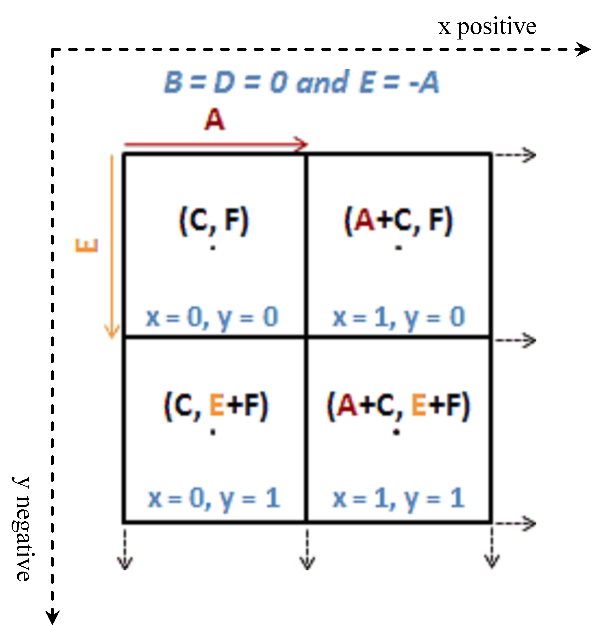
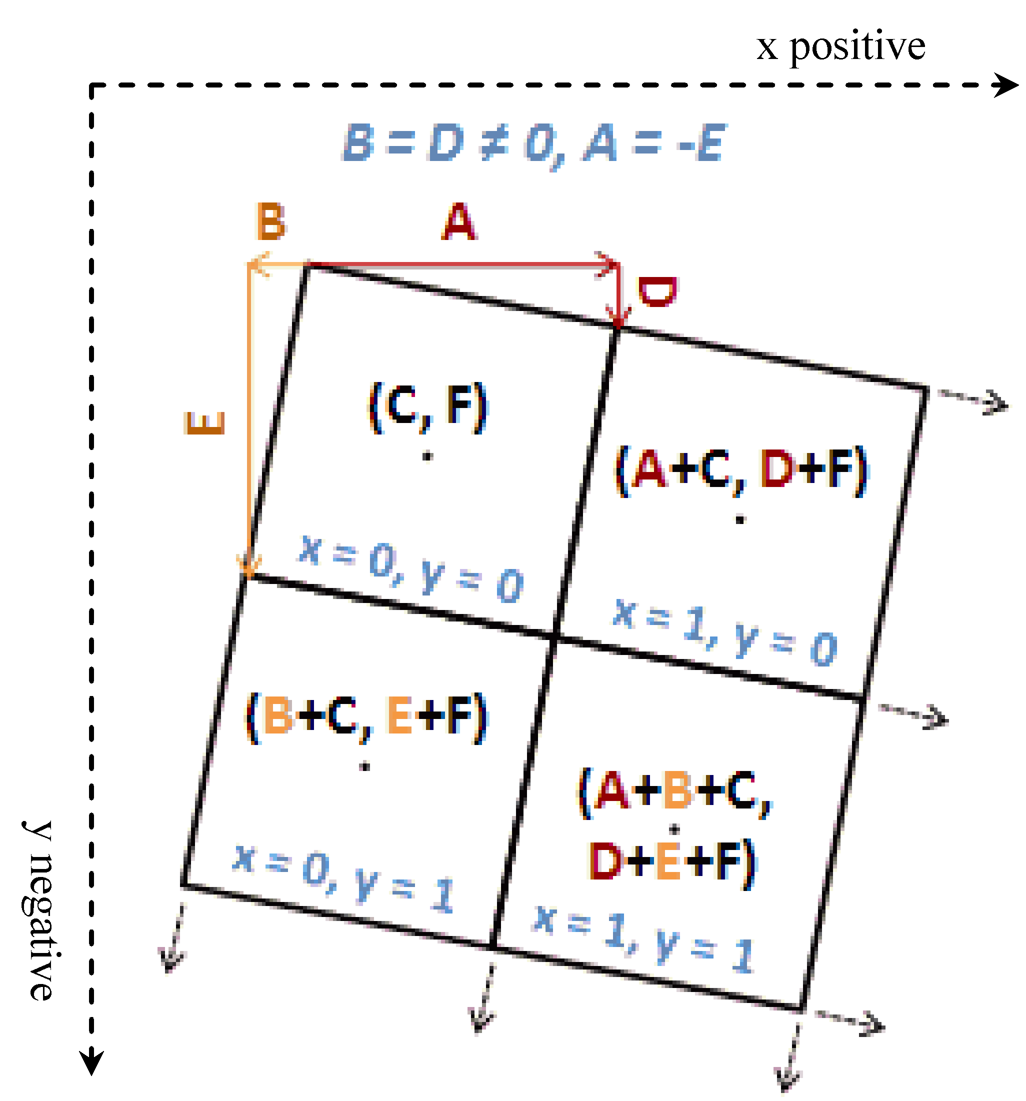
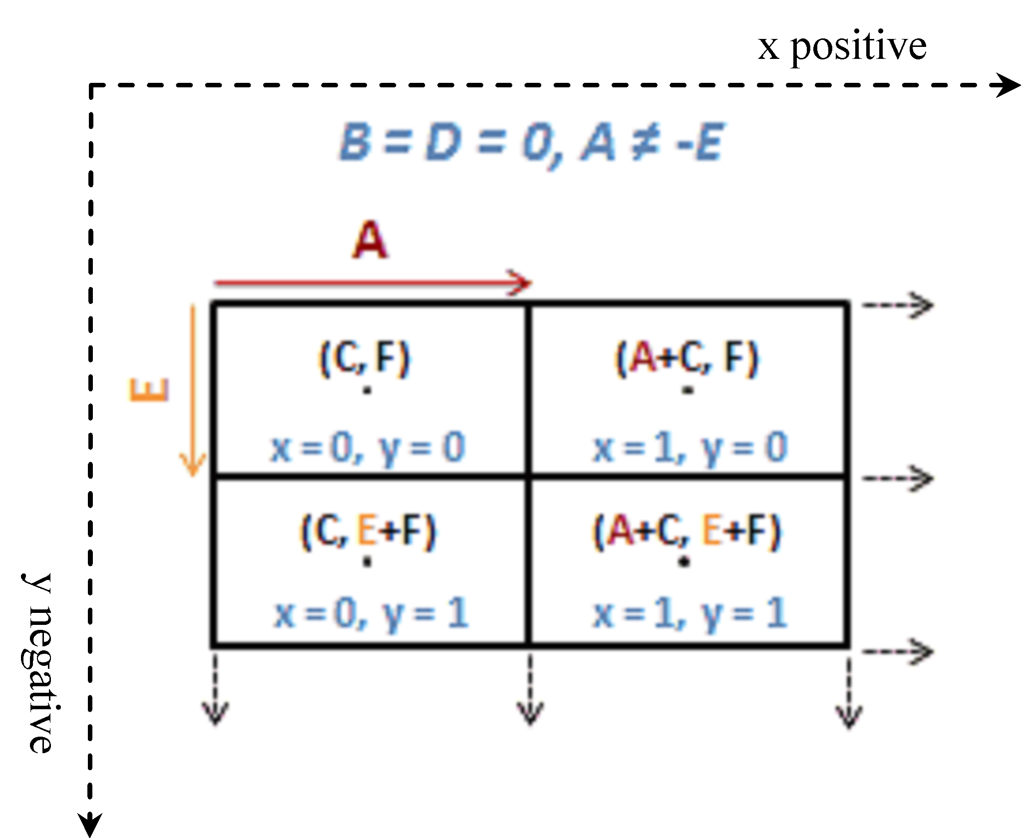
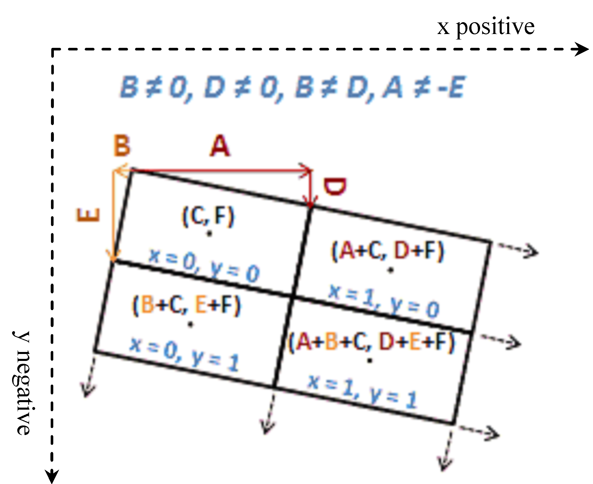
The generic meaning of world file parameters are:
Graphical view of above described world files parameters and computed values of the four first upper left pixels of an image:
|
|
Case 1: Square pixels, no rotation |
Case 2: Square pixels, with rotation |
|
|
Case 3: Rectangular pixels, no rotation |
Case 4: Rectangular pixels, with rotation |
Please keep in mind that world file does not support any raster clipping or coordinate system information. That is - clipping boundary information (if selected during picking area of interest operation) is lost, only original rectangular image boundary is retained. The name of the resulting world file is equal to raster image file name, while file extension of the world file is based on the raster file's extension, as described in supported file formats above.