|
Infra Suite |
|
Infra Suite |
|
GEOREPORT |
Reporting functionality enables creating a  Word Document (.docx) report using AutoCAD drawing containing checked-out recordings and actual imagery raw data. In case raw data represents a video recording, affected video frames will get extracted and saved as series of images.
Before running this functionality please read following customization instructions:
Creating imagery report involves following steps:
Once the tools is started, you are asked to define the facility name. This is a common name/number of recorded object(s) in viewport used in document templates via document template placeholders. Entered facility name may contain spaces and/or special characters. After facility name is set, you also need to specify resulting report document name and location. Report generation begins right after you click on Save button.

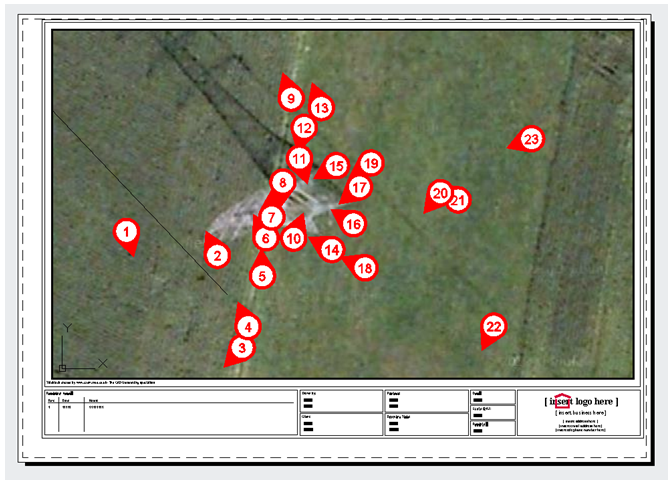
Overview map layout template with viewport and enumerated checked-out recordings
Once report is generated, enumeration will be kept or removed from drawing features based on Keep image numbering option in GeoView settings.
|
Producing imagery report in .docx format using GeoView for AutoCAD does not require Microsoft Office or any other word processing package installed on your workstation. To inspect reporting results in .docx format you, naturally, need an application that can read this format, be it Microsoft Office, Open Office, or any other viewer capable of displaying .docx contents. |