Imagery reporting is based on set of .docx document templates which get filled with recordings data during run-time. You may additionally customize ready-made document templates, or use document template placeholders which get populated with data. Also, you may create multiple document templates and pick most suitable ones using GeoView settings. There are following report "parts" (all of them being optional) that may get produced and merged into final document during reporting process, in following order:
- Introductory part - any document or document template that gets inserted at the beginning of the final report.
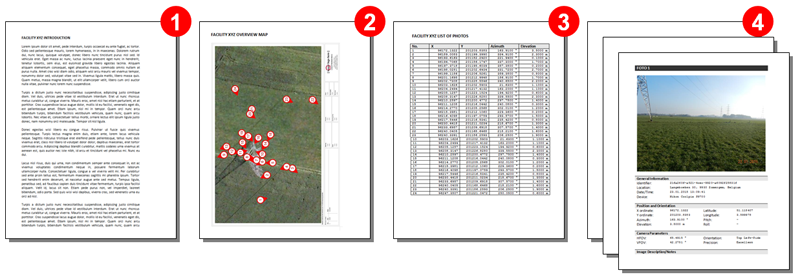
- Overview map - an overview map with enumerated recordings, based on currently selected layout.
- Imagery list - a list of visible recordings in a layout viewport, represented as a single table.
- Single image - detailed representation of visible recordings in a layout viewport, possibly including a recording photo.
- Ending part - any document or document template that gets inserted at the end of the final report.
Types of available GeoView for AutoCAD document templates
When selecting and customizing document templates for GeoView for AutoCAD, please keep in mind following:
- There are many possible configurations of single image document template, but there are two major designs - one image per page (gv_template_image_single.docx), or two or more images per page (gv_template_image_multiple.docx). In case of one image per page template, please set Single image page break option to "Yes".
- Imagery list template needs to contain at least one table with columns containing document template placeholders.
- You can customize overview map and single image bitmap widths using Overview map width and Single image width options.