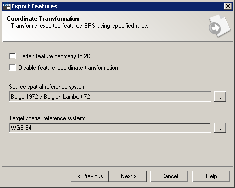
Coordinate Transformation wizard page enables feature geometry re-projection from drawing coordinate system to resulting data file's coordinate system:
Export Features wizard Coordinate Transformation page
This wizard page provides following options:
It also provides following navigation buttons:
Specifying Spatial Reference System
Spatial reference system (SRS) or coordinate reference system (CRS) is a coordinate-based local, regional or global system used to locate geographical entities. A spatial reference system defines a specific map projection, as well as transformations between different spatial reference systems. If coordinate transformation is not disabled, it is possible to set both source (current drawing's) and target (resulting data file's) coordinate systems, thus providing parameters for feature geometry coordinate transformation.
Feature Export wizard enables changing both source and target spatial reference system by clicking on  button next to the source spatial reference system name:
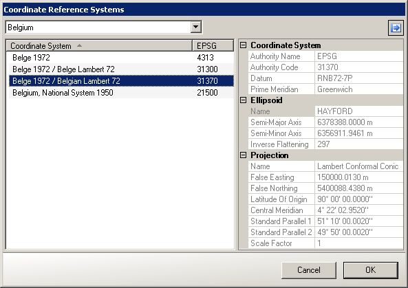
Coordinate Reference System dialog