A coordinate system (or spatial reference system) is a coordinate-based local, regional or global system used to locate geographical entities. A coordinate reference system is usually defined by map projection, an ellipsoid definition, a datum definition, one or more standard parallels, and a central meridian. It is recommended that you specify a default spatial reference system to take advantage of the Holixa Infra Suite coordinate transformation capabilities.
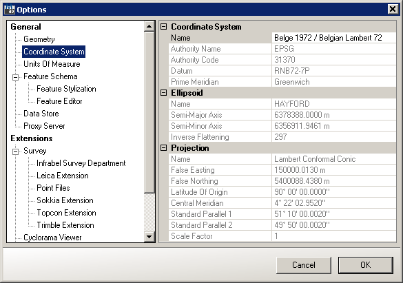
Coordinate System settings in Options dialog
You can change default coordinate system by clicking on  button next to the coordinate system name. This launches Coordinate Reference System dialog containing a drop-down list of regions/countries and associated coordinate systems (including their
  EPSG numeric codes):
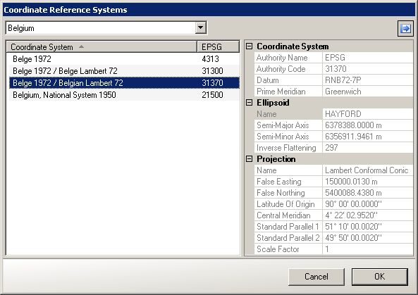
Coordinate Reference System dialog
The Coordinate Reference System dialog displays following coordinate system properties: