Projected coordinate system is a coordinate system defined on a two-dimensional surface. Unlike a geographic coordinate system, a projected coordinate system has constant lengths, angles, and areas across the two dimensions.
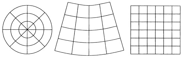
The three principal types of flattened surfaces: planar, conic, and cylindrical grid.
Locations on a plane are defined by polar or Cartesian (rectilinear) coordinates, with the origin at the center of the grid. Each location has two values (X and Y ordinate) relative to the origin: these specify its horizontal position and its vertical position. The coordinates at the origin are x = 0 and y = 0. You can equate the longitude values with the X axis and the latitude values with the Y axis. See Map Projection for more info.