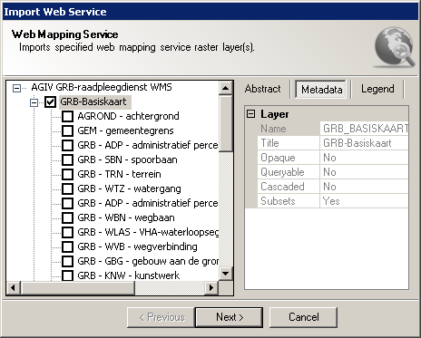
Selecting Map Layers wizard page enables specifying picked web mapping service's layer(s):

Selecting Map Layers wizard page
This wizard page provides following sections:
It also provides following navigation buttons:
WMS layer represents a basic unit of geographic information that may be requested as a map from a server. The layer element can enclose child elements providing metadata about the layer. The meanings of those metadata elements are described in the table below:
Property |
Description |
Abstract |
Represents a narrative description of the map layer. |
Name |
Name of the map layer. |
Title |
Human-readable name of the map layer. It also appears in the layers tree picker on the right side of the wizard page. |
Opaque |
If true, indicates that the layer represents an area-filling coverage. For example, a map that represents topography and bathymetry as regions of differing colors will have no transparent areas. The opaque declaration should be taken as a hint to place such a layer at the bottom of a stack of layers. |
Queryable |
If true, indicates that WMS server supports GetFeatureInfo operation on that layer. |
Cascaded |
If true, indicates that the layer was obtained from an originating server and then included in the service metadata of a different server. |
Subsets |
If true, indicates that the server is able to make a map of a geographic area other than the layer's bounding box. |
Legend |
Represents a graphical legend of the layer contents. |