The tolerance value indicates the amount by which the geometric characteristic can deviate from a perfect form. It is expressed in default linear units. This value represents "general" tolerance, but its actual meaning depends on specific context - for example, tolerance reflects the distance that two points can be apart and still be considered the same (for example, to accommodate rounding errors). The significance of the value may also depend on whether or not the spatial data is associated with a geodetic coordinate system.
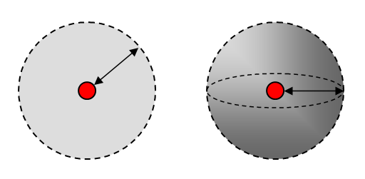
Tolerance distance in 2D and 3D space
The tolerance is used to set the minimum distance between coordinates in geometric operations such as topology validation, computing intersections or containment, finding duplicate geometries, as well as in some editing operations. Feature processing operations are influenced by the tolerance value, which determines the minimum distance separating all feature coordinates (nodes and vertices) during those operations. Depending on context, the tolerance is an extremely small distance (the default is 0.0001m). It is used to resolve inexact locations of coordinates during clustering operations. When processing feature classes using geometry operations, coordinates whose X,Y and Z ordinates are within the tolerance of each other are considered to be coincident (i.e., share the same location in space).
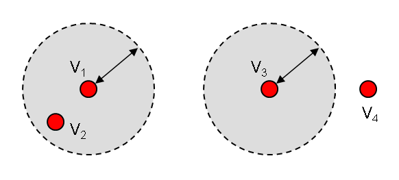
Vertices V1 and V2 are considered identical, while vertices V3 and V4 are not
Please keep in mind that certain feature data stores also have built-in, customizable spatial resolution value. It is suggested that you use identical tolerance values for both geometry and a data store (if any).